the world needed a way to find water inexpensively, so since 2011, I developed an innovative and revolutionary methodology for identifying and mapping aquifers. I REGISTERED FOR UNIVERSITY IN 2014 TO FURTHER MY RESEARCH AND GRADUATED WITH A BACHELOR OF ARTS in the honours program for GEOGRAPHY AND ENVIRONMENTAL STUDIES.
THE METHODOLOGY COMBINES ART WITH SCIENCE AND GEOGRAPHY. IT IS EXCEEDINGLY ACCURATE WITH AN UNPRECEDENTED CORRELATION COEFFICIENT OF 1.O IN REAL TIME AT A FRACTION OF THE COST OF GROUND PENETRATION RADAR, SATELLITE MAPPING SUCH AS THE G.R.A.C.E. PROJECT, NUCLEAR MAGNETIC RESONANCE, OR ELECTRICAL RESISTIVITY/CONDUCTIVITY.
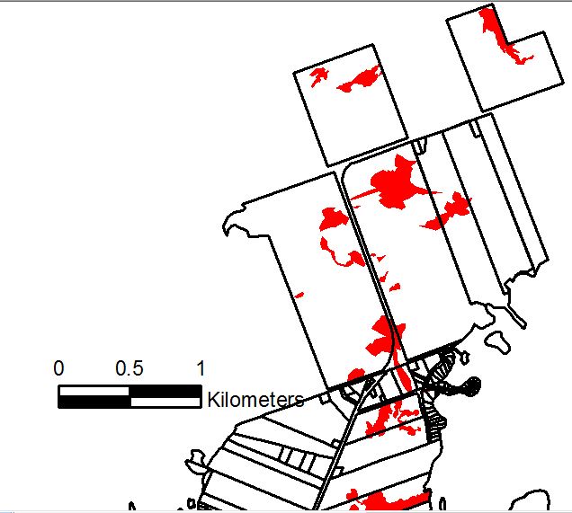
In 2012, I was able to identify and map Karst Aquifers (water in limestone caves). For scale, the rectangular lots in the centre are 200 acre farmlots.
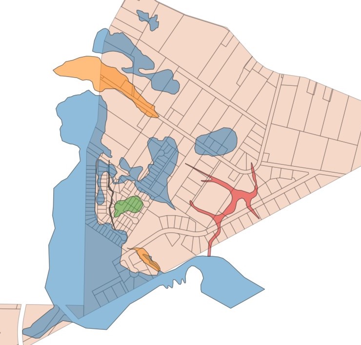
In 2017, I was able to identify and map Karst, Gravel Overburden, Shale and Overflow Spring Aquifers
As of 2021, I am now able to identify and map Karst, Gravel Overburden (Eskers), Sand Overburden (Kames), Riverstone Overburden (also Eskers), Shale (Fractured Limestone), Overflow Spring and Artesian Aquifers for a total of seven different types of aquifers.
All of the work I do is entirely without drilling expensive wells to find out what Aquifers exist in an area.
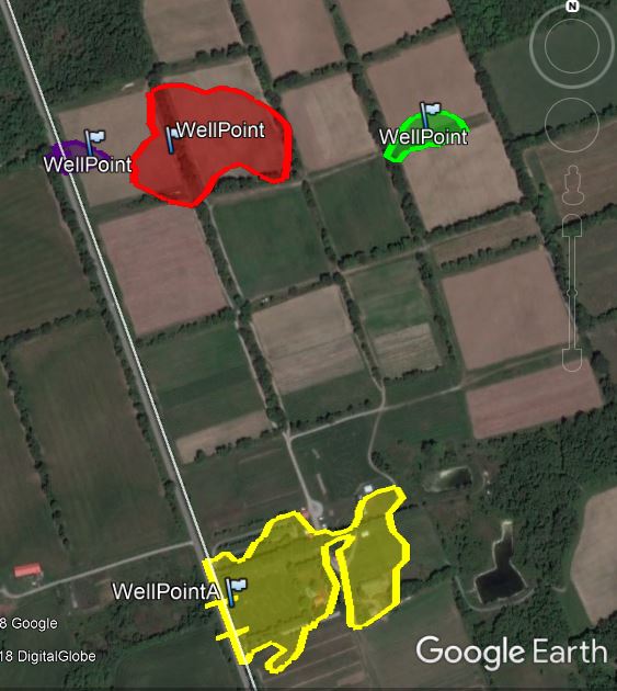
When I recommend to drill a well, it is always into a high yield aquifer (over 10 gallons per minute).
To be clear, there have never been such accurate and revealing aquifer maps ever produced at this scale. The top hydrogeologists say that no one can know where the aquifers actually are or what type of aquifer it is until someone drills a well. That statement has been true, until now.
Hydrogeologists are able to predict the likelihood of aquifers being present in an area but that is all. They still have to drill or utilize expensive instruments to probe below the surface. Even with the instruments that they have, they will never have access to maps with such precision as these maps. Part of my analysis of Aquifers allows not only the delineation as a Polygon (blob shape) in the x and y axis (geographic coordinate systems), but also along the z axis with measurements of the depth or height from the earth’s surface to the Static Pressure Shell (Piezometric Head) of the aquifer.
The landowner always will know exactly what Aquifers are on their property..